

Tuesday 11 February 2014
And together, it happened.
Refining the variables

Monday 10th February PM. We come together in a plenary with the mappers from Barrios Altos and Jose Carlos Mariategui to share fieldwork experiences. The reflections made pointed to the importance of making visible what is already known, but also the discovery of new aspects through the transect walks. For many, the technical input was appreciated as a means of gathering the information in a systematic way. But more so, the mapping workshop is appreciated for highlighting the need and importance of organization amongst the inhabitants; this, not only to resist unwanted change, but drive the desired visions for the respective areas.


Monday 10 February 2014

3D Reconstruction

We are starting the reconstruction of the 3d model and so far its looking great. Model will be sent remotely to London for further processing and printing.
Making the contradictions visible

Sunday 9th February AM- The mapping team prepares to walk the landscape in three areas. Tracing and juxtaposing the borders of the current occupation, the proposed limit in certified plans, and the foreseen future expansion for each of the 'Agrupacion Familiar', reveals a complex and contested field of actors. As described by one of the mappers these include, the first comer, the corrupt, the tourist and the newcomer.

Combing Barrios Altos


While mapping, the leaders of Barrios Altos, also take this opportunity to reach out to their neighbours and inform them about how to acquire basic services as well as resist eviction.
Sunday 9 February 2014
A closer look
 |
| Barrios Altos Area today. Image via Drone Adventures. |
Sunday 9 February PM. Incredible results from Drone Adventures! These "close to real-time" updated images were incredibly valuable in yesterdays and today's field work, as people depended on the aerials captured from the mapping drone to define critical territorial borders in areas undergoing otherwise 'invisible' change..
These limits were later mapped in greater detail by local mappers, who walked the boundaries using GPS trackers. Details on the field trip in JMC and Barrios Altos to follow..

Sneak Peek - Mapping drones in Lima
Monday 3 February PM. Pilot flight of a mapping drone in the JCM settlement in Lima Peru with DPU, CASA UCL and Drone Adventures. The team had to reach a height of about 2000m. to capture the whole area. Great launch!
For the mappers interested in our location, we were here:
Mapping from the sky completed!

Saturday 8 February PM. While several members of the local
community were watching the deployment of the “avioncitos”, we completed the
mapping of the Barrios Altos + Lima-city-center areas. The eBee drones made a
wonderful job in mapping more than 4 square kilometers of the capital under the
“attentive supervision” of the local birds.
Saturday 8 February 2014
phone mapping
 |
| First day at the workshop Thursday 6th February pm |
Popular applications such as twitter has great potential for future uses, as it is already known to some of the mappers. However, the workshop identified categories that require the use of survey type collectors. For Barrios Altos, there was a need of crowdsourcing information from land uses of individual buildings, to building condition and census data. Twitter was used as a method for submitting uncategorized information and cases of emergencies.
Early visualizations of geolocated information from the field work in Barrios Altos shown below. Results send directly from Lima to London at CASA UCL.

Tracing the axis of change

Friday 8 February PM.
The discussion takes us to explore wanted and unwanted processes through various
axes of change. Tracing such axes takes
us to identify six streets where different visions of Barrios Altos meet. These
range from heritage preservation to the defacing of the area through the
peppered emergence of storage. Still to be ascertained is the correlation
between de facto occupancy rights, de jury property rights and the many grey
areas in between that threatened both the possibility of preserving the
historic heritage and popular dwelling of the heart of Lima.
Why to map?

Friday 8 February PM.
Community leaders and residents from Barrios Altos, CIDAP and the DPU team
come together to plan the mapping that will be done on the field tomorrow. We
start by discussing WHY TO MAP. Mapping
is identified by the communities as a means to document and denounce otherwise
invisible processes of change such as slow evictions. It is also seen as a
strategic activity to understand trends and ongoing processes of chance by
institutions and real estate developers. Last but not least, mapping is seen as
a tool to capture the physical and social architecture of Barrios Altos and the
room for manoeuvre to promote strategic interventions.

Friday 7 February 2014
Mapping from above - mapping from below

Thursday 6 February
PM. Twenty two women and men from 10
community organisations in the extensions of Jose Carlos Mariategui come
together with the team from DPU, CENCA, Foro Ciudades para la Vida
and CASA to decide what to map. Zooming out to the wider territory of the quebradas reveals a map of constantly
shifting borders and interactions and the community mappers decide to make this
the focus of the fieldwork on Sunday. The borders define not just the current territory but the
multiple visions and practices that converge in shaping the area, from the slow
occupation of the slopes and the traces of quotidian actions to dwell the ravine,
to the 'pop up' developments driven by informal land trafficking.

Expanding the possibilities for spatial analysis

Thursday 6th February
AM. While the Drone Adventures team continues rendering the high resolution images captured
in Jose Carlos Mariategui, the output from the pilot flight is printed to be
used as a basis for the discussions with community mappers later in the day.
Although the image above was captured at 500 metres from the ground, the level
of detail is impressive and the possibilities for spatial analysis exciting!
Thursday 6 February 2014
“I want an ‘avioncito’ too!”

Wednesday 5th February PM. Excited about the flight of the drones or 'avioncitos', the kids from 12 de Octubre in José Carlos Mariátegui were eager to be part of the landing crew.
Ouch!
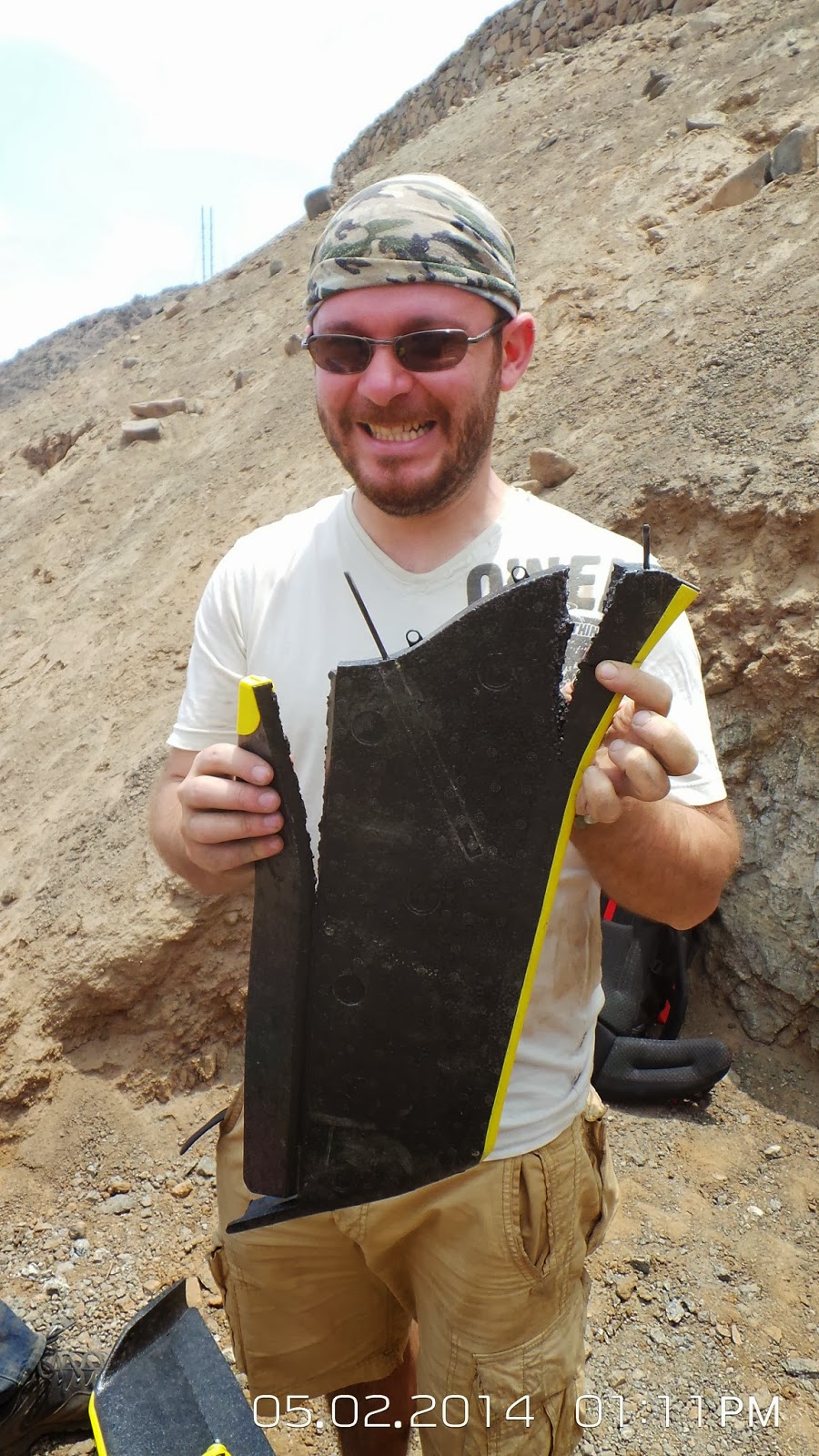
Wednesday 5th February PM. Compared to yesterday, the landing today was rather eventful on the hills of Jose Carlos Mariátegui.
Subscribe to:
Posts (Atom)